Overview
Project's Context
Problems
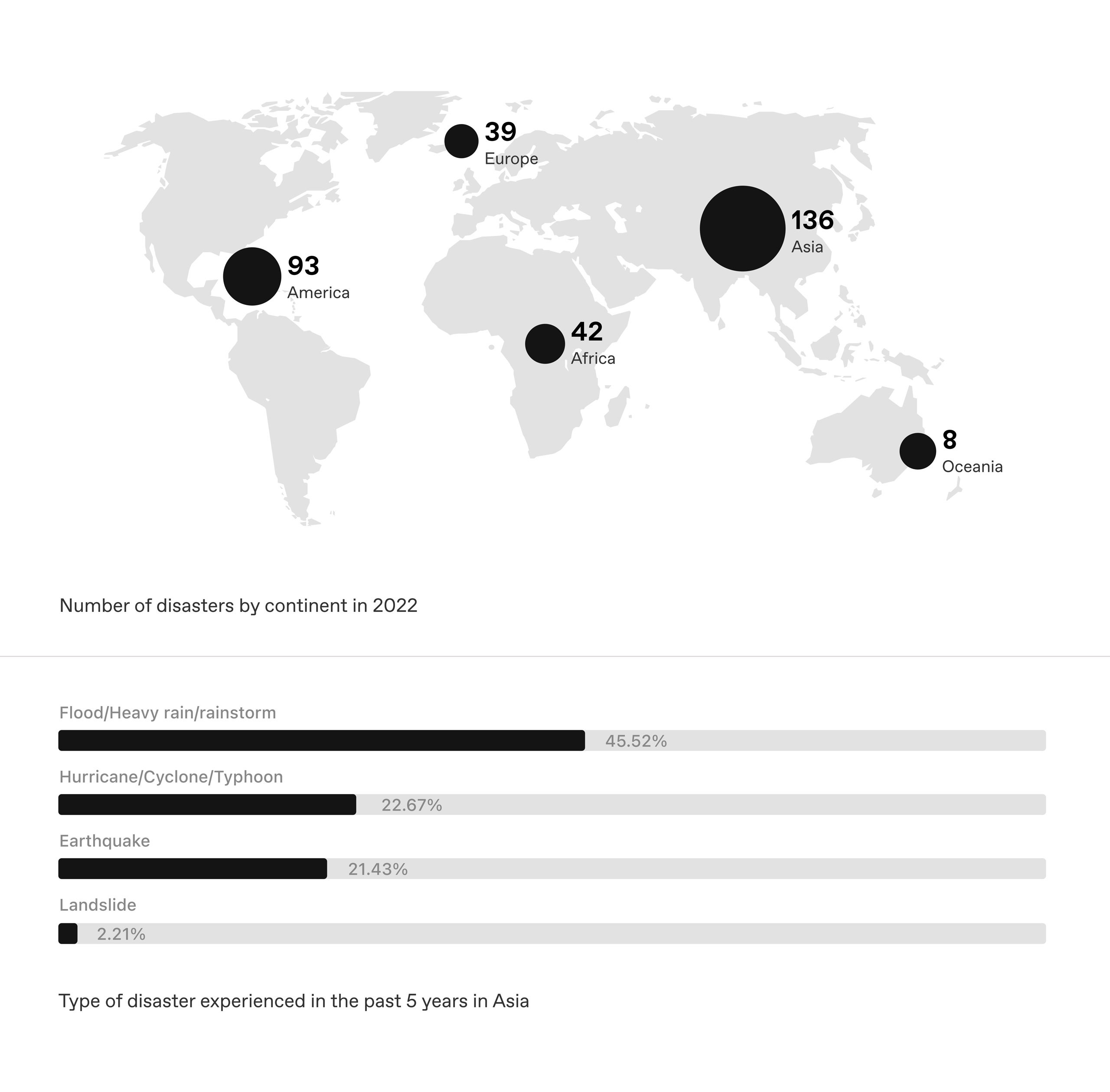
This research focuses on Asia, one of the most disaster-prone regions globally, experiencing annual typhoons, floods, and earthquakes. Rescuers play a vital role in improving survival rates but face severe weather, unpredictable terrain, and network failures, compromising their safety and effectiveness.
Solutions
01 - Provide real-time updates
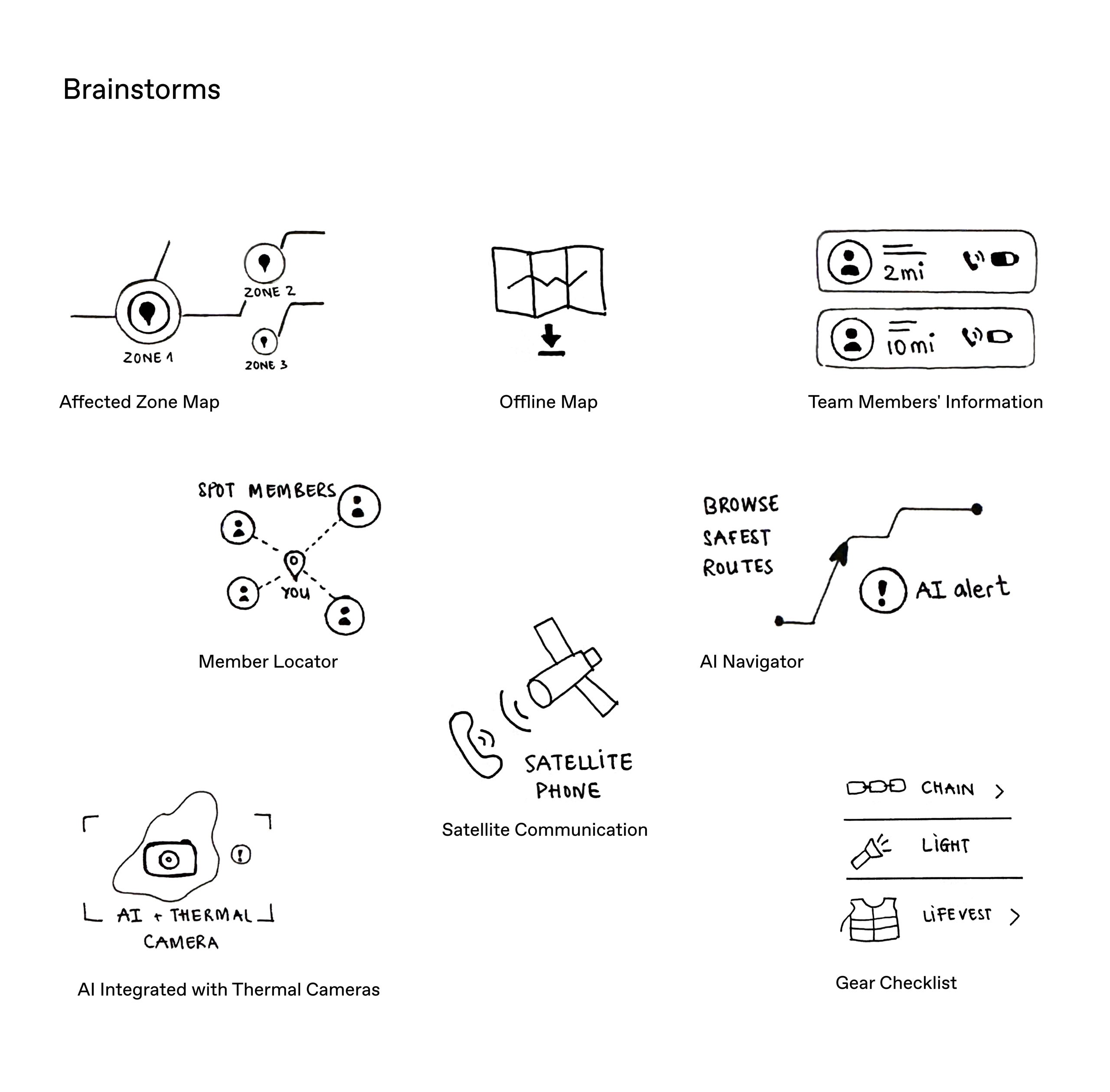
Integrate weather and terrain updates that enable rescuers to make informed decisions based on the latest conditions, ensuring safer and more efficient response strategies.
02 - Ensure safe navigation
Implement GPS-enabled, AI-powered maps that guide rescuers along the safest routes, with alerts for potential hazards and unstable terrain.
03 - Enhance communication
Utilize satellite communication to maintain connectivity in areas with no network coverage, ensuring that teams can communicate continuously, even under extreme conditions.
Research
Asia - Disaster Prone Region
Asia experiences frequent and intense natural disasters such as typhoons, floods, landslides, and earthquakes. Countries like Vietnam, the Philippines, and Indonesia face significant challenges, including infrastructure damage and a high density of affected populations. The need for effective SAR operations is paramount in these regions.
Why we care about rescuers
Rescuers are the frontline responders in disasters, facing significant risks and challenges. Empowering them with tools that enhance their safety and efficiency not only saves lives but also maximizes the impact of SAR efforts.
Rescuers: Critical to Survival Outcomes
Rescuers are pivotal in disaster response, significantly influencing survival rates, particularly during the critical first 72 hours
High-Risk Work Environments
Rescuers face extreme physical and psychological challenges, including unstable terrains, adverse weather, and the pressure of life-saving decisions.
Communication Failures
Networks failures leads to significant delays in coordinating relief efforts, resulting in loss of life and preventable injuries
Persona
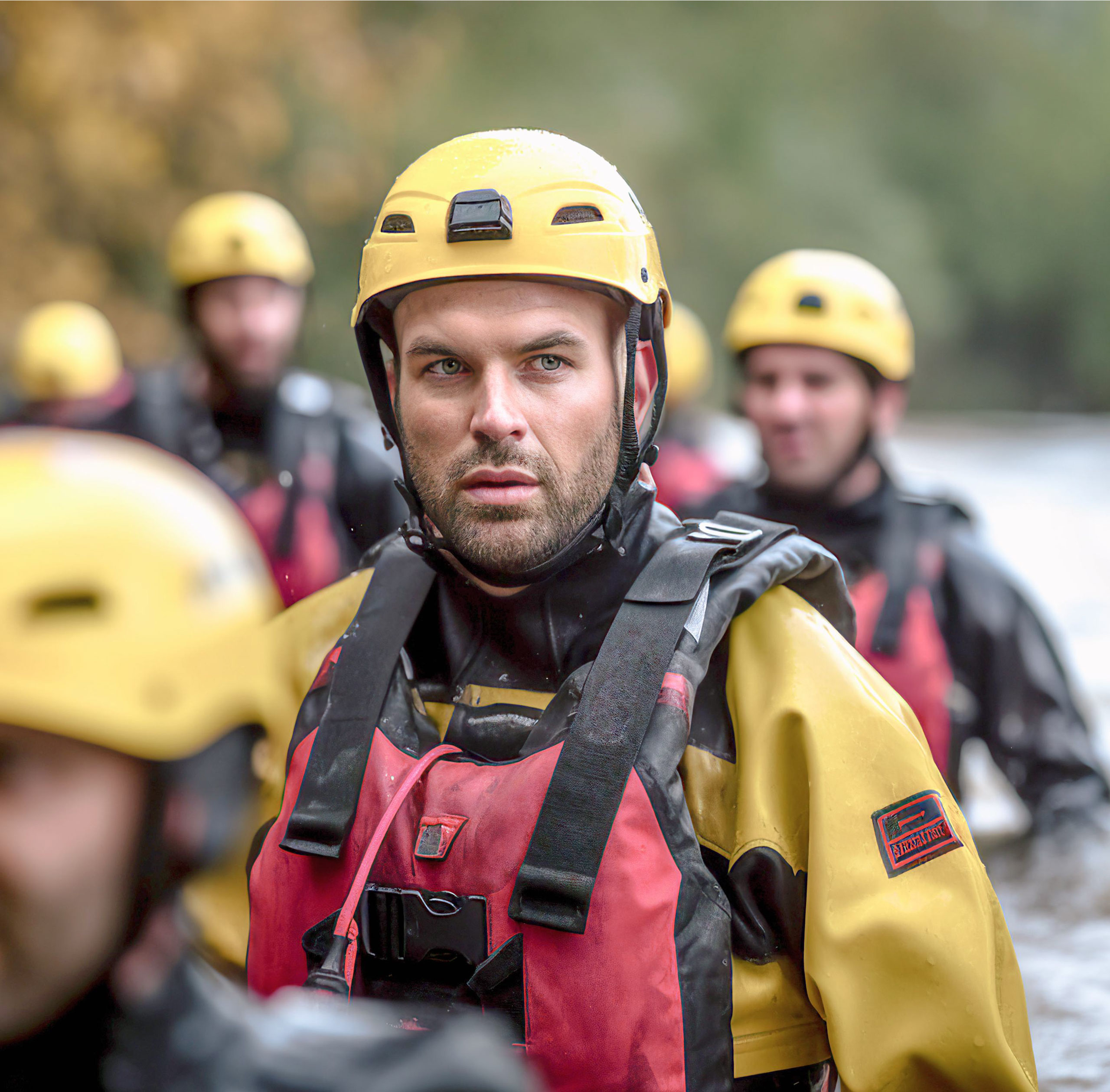
“During a rescue mission, a landslide caused rocks to fall on our vehicle, leaving two teammates seriously injured. It was chaotic and delayed getting them the help they needed.” – Minh
Needs
Strives to arrive at the reported disaster scene as quickly as and avoid delays.
Ensures safety of both the victims and his team throughout the SAR process.
Pain Points
Encounters dangerous and unstable terrain, especially in rural areas or unfamiliar sites.
Experiences delays caused by severe weather conditions.
Struggles to communicate with other responders due to network failures.
Motivations
Has desire to save lives because he feels emotionally connected to all victims.
Has the pride that comes from knowing his work directly affect survival outcomes.
Behaviors
Understanding the emotional strain of SAR work, and care about teammates’ well-being during missions.
Comfortable using technology and values its benefits of technology in SAR operations
Show a high level of commitment and enthusiasm for helping those in need.
Pov & How might we
POV
Josef needs accurate real-time weather and terrain information to avoid delays and risks while reaching victims
How might we
How might we deliver accurate, real-time weather updates to Josef during rescue missions?
How might we alert Josef to dangerous terrain to ensure safe navigation and reduce risks?
How might we maintain communication with Josef's team during network outages?
Features
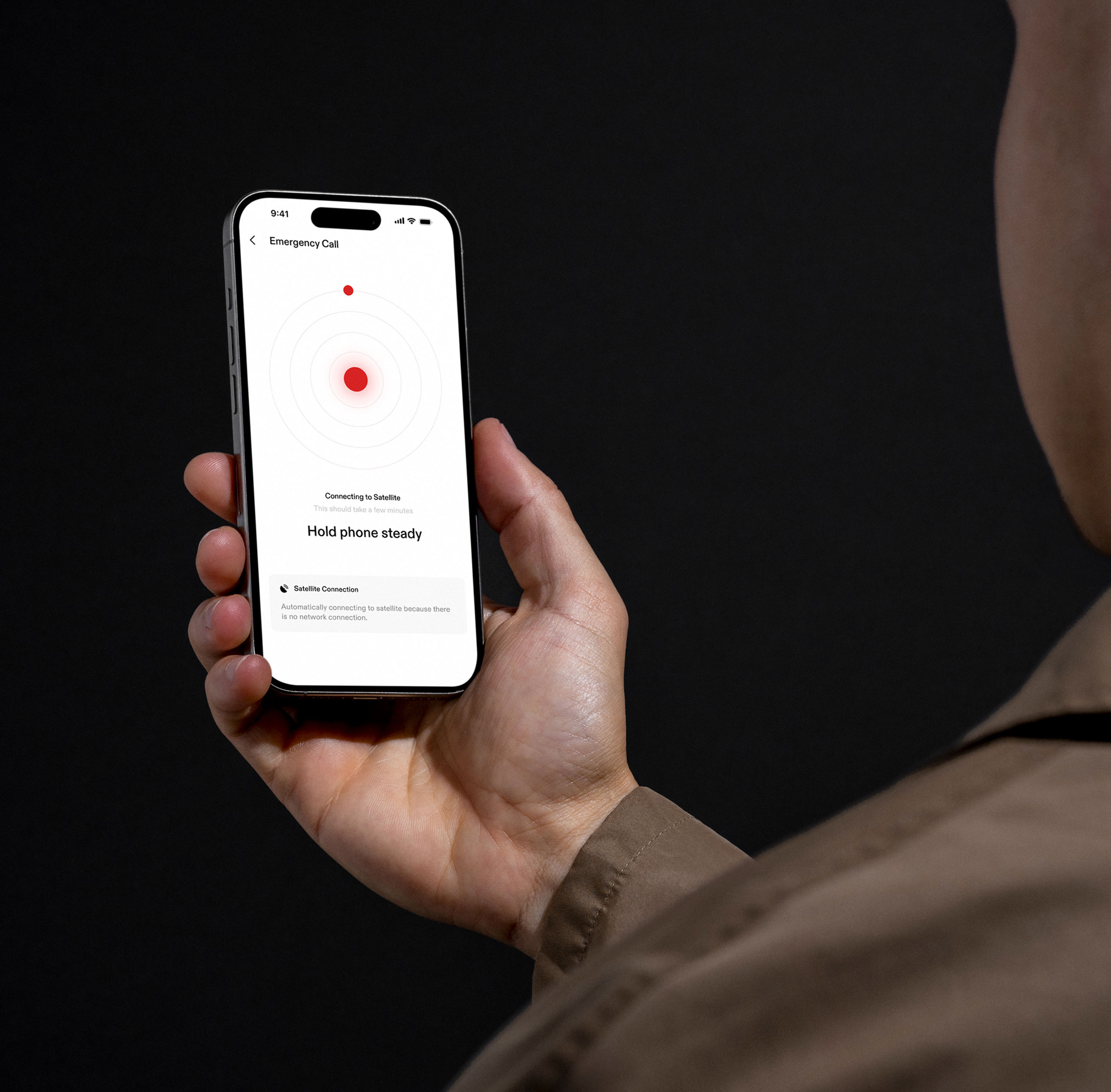
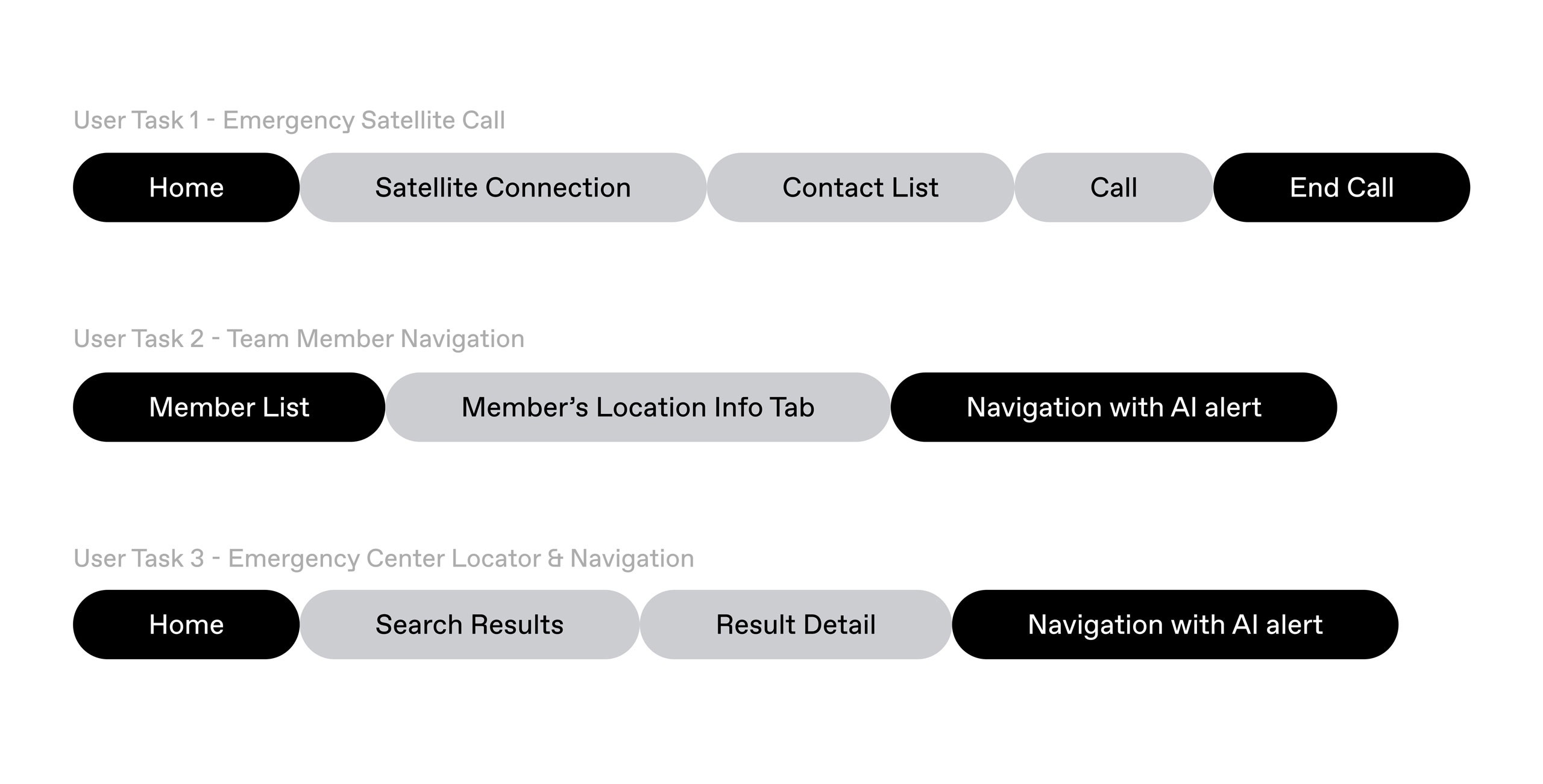
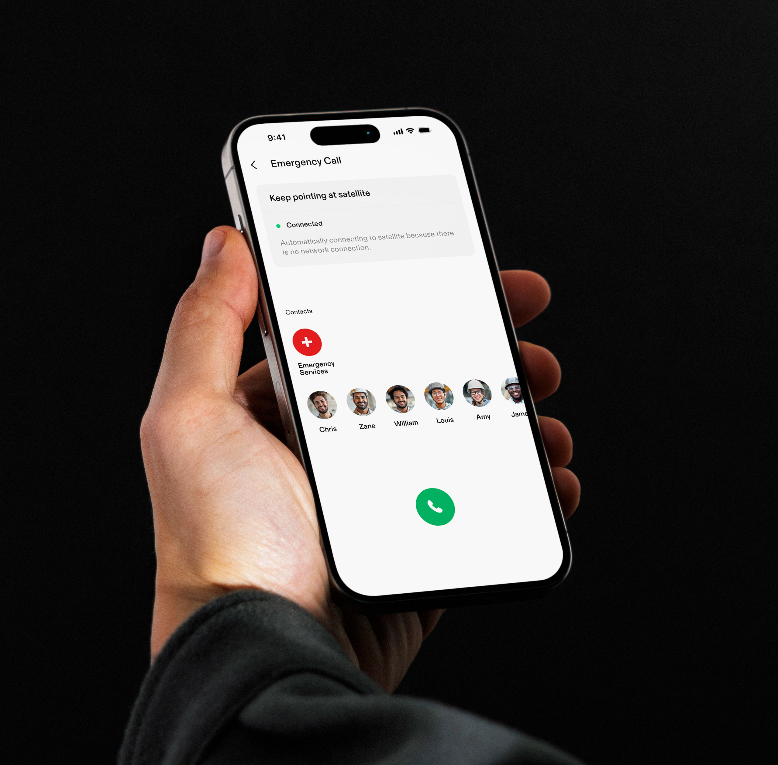
01 - Emergency Satellite Call
Networks failures leads to significant delays in coordinating relief efforts, resulting in loss of life and preventable injuries
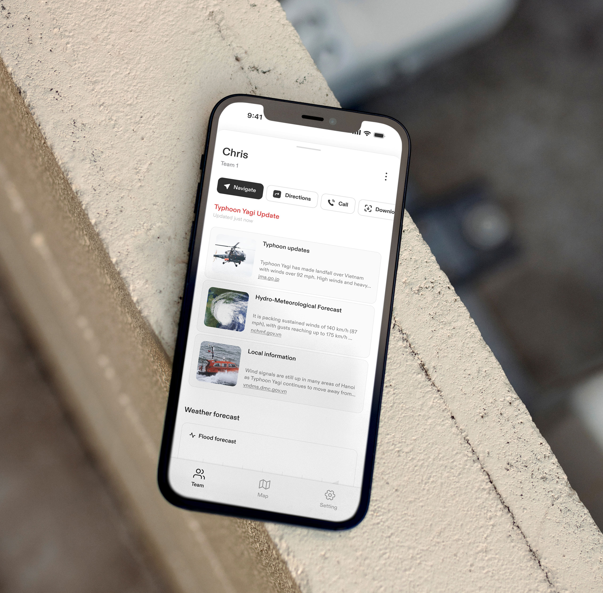
02 - Team Member Tracking & Navigation
Track and navigate to team members in real-time. The AI system offers real-time alerts about any potential hazards on the route, ensuring Josef can travel safely and efficiently.
03 - Emergency Centers Location & Navigation
Locate nearby response centers and navigate with AI alerts
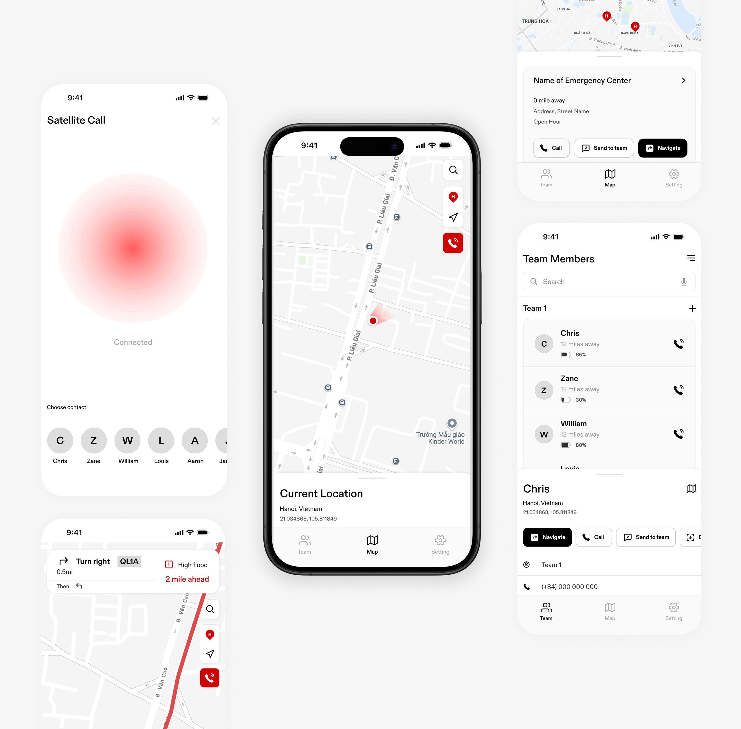
Low Fidelity Wireframes
The low-fi wireframes focused on defining the app’s core structure and user flow, emphasizing ease of use in high-stress environments. Objectives included feature placement, buttons and navigation simplicity and preparing for usability tests.
usability test and improvements
POV
Users valued the "Zone Summary" feature for understanding conditions.
Challenges in accessing nearby hospitals through search functionality.
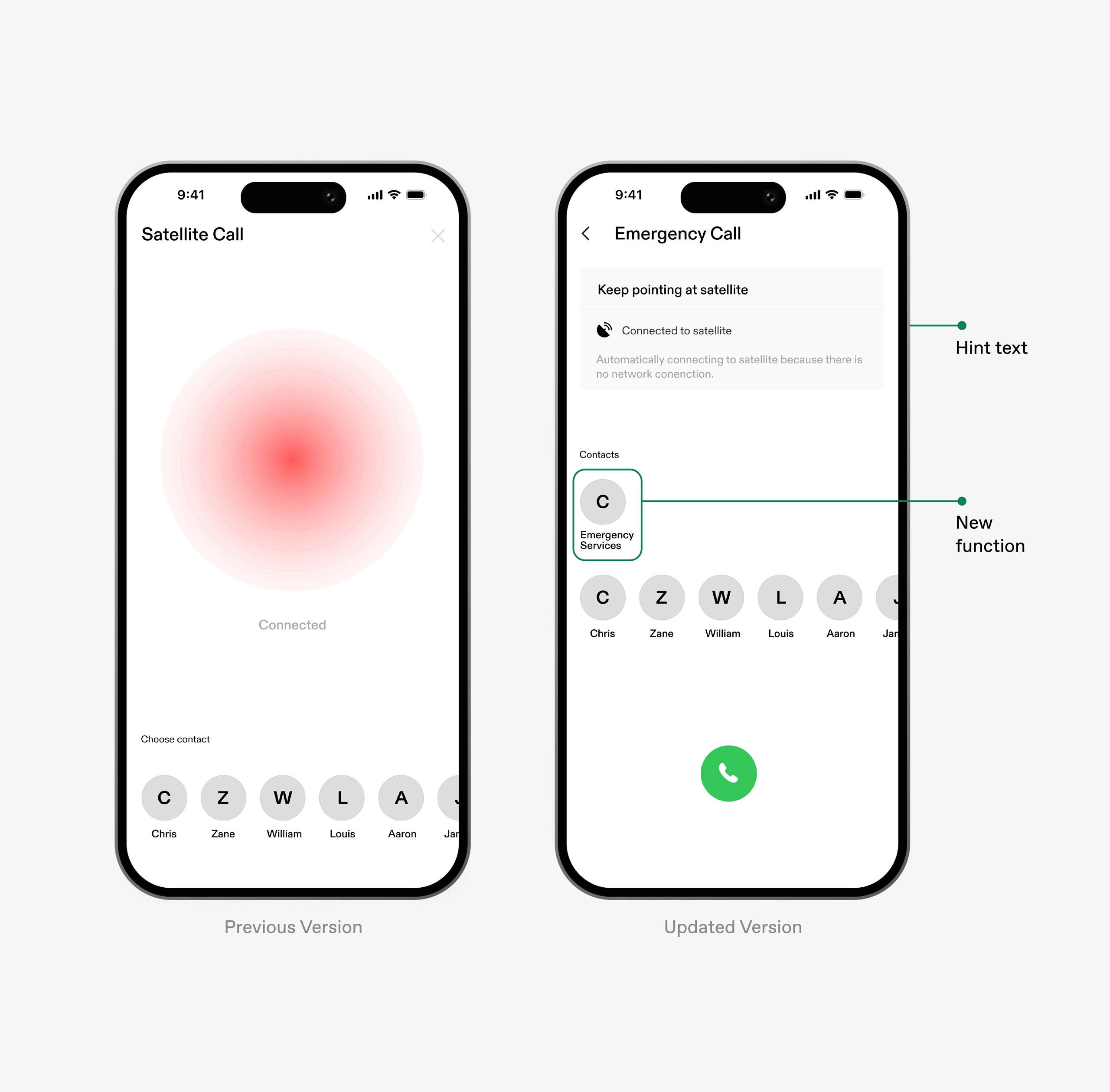
Users expected to be able to call emergency services in the first feature - satellite call
Updates
After gathering and analyzing all feedback and observations from the tests, Feature 1 was updated to include emergency services and traditional network calling capabilities, as well as adding system status and hint text for more clarification.
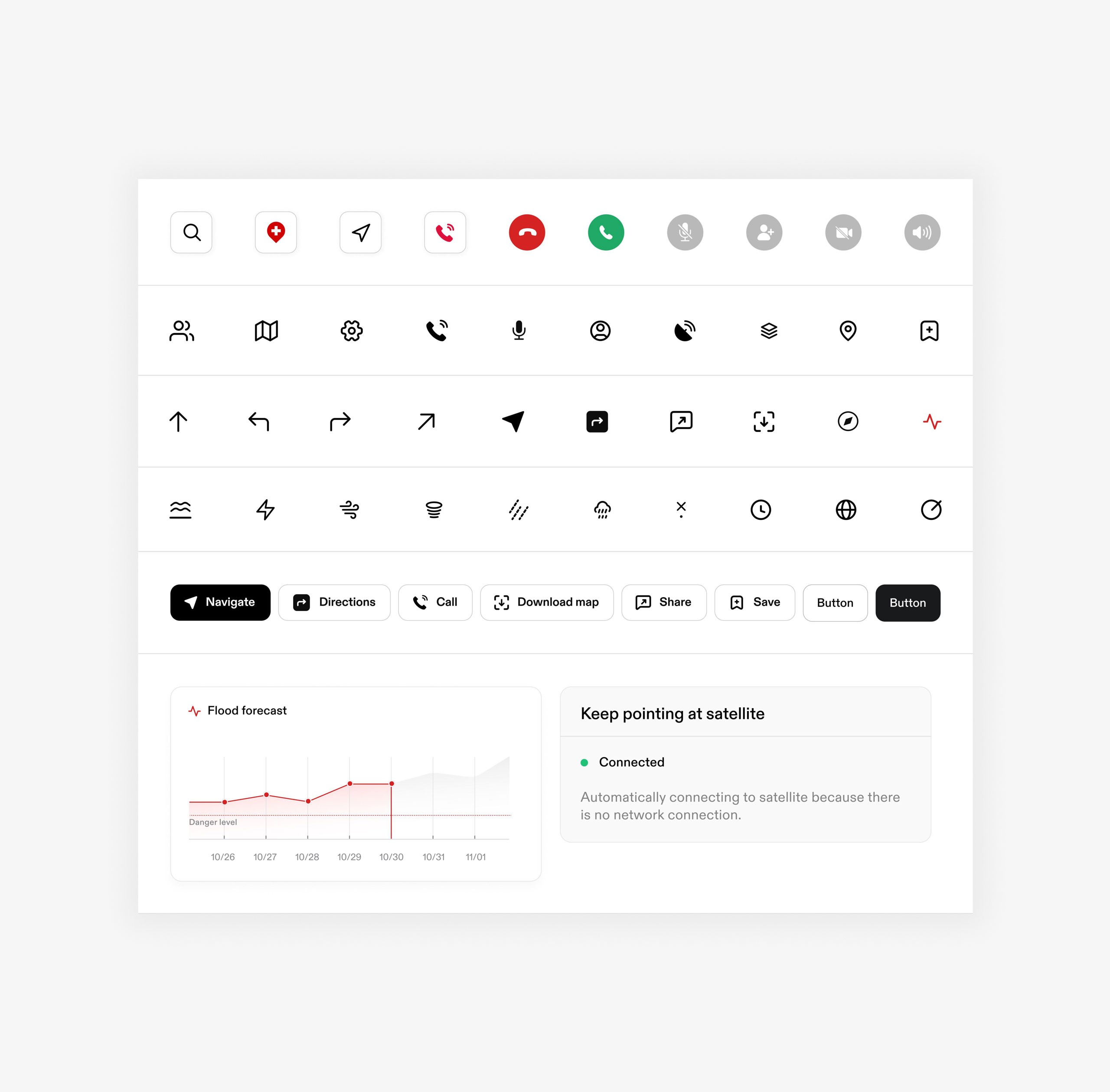
Styleguide
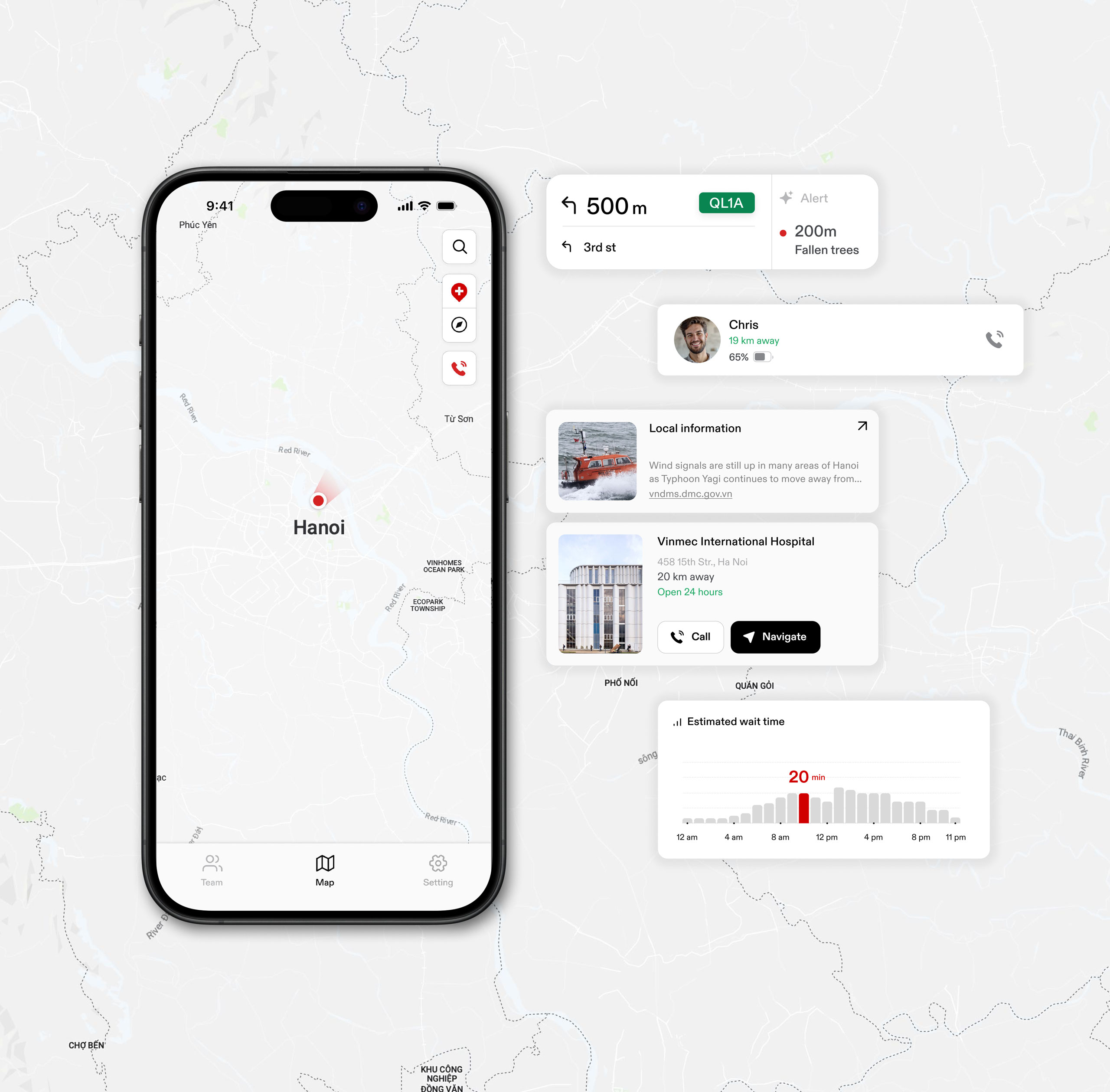
High Fidelity Wireframes
This stage focused on using the style guide to incorporate images, graphics, icons, and components to enhance visuals and communication information effectively.
key takeaways
The SafePath project addressed inefficien-cies and dangers in search and rescue (SAR) operations. It provided valuable insights into designing for high-stakes environments, where technology like thermal cameras, drones, GPS, and satellite imagery plays a critical role.
This project highlighted the importance of understanding user pain points in extreme contexts and balancing intuitive interfaces with robust functionalities to ensure accessibility in stressful environment. This project reinforced my belief in creating impressive designs with purpose, precision, and harmony.

